According to Sophia.org, visual culture, a field of academic study that emphasizes the cultural meaning of a work of art rather than its aesthetic value, often involves the analysis of visual communication.
This type of communication can be a form of nonverbal persuasion. Because it functions on a subconscious level, the effects can sometimes be quite persuasive; advertisers, marketers, and propagandists know this.
Visual propaganda is a way people try to influence others by projecting their belief systems through pictures or film. The Nazis were notorious for their use of political and ideological propaganda.
These advertisers, marketers, and propagandists rely on snap judgments. Pictures can be very persuasive simply because visual images tend to stick in people’s minds, and people are quick to make judgments on what they see. These judgments can then become ingrained as facts without people even realizing it.
Propaganda has existed if there has been politics and artwork to go along with it. Visual propaganda has existed in many different forms; this aggressive method of advertising can thus have a strong influence on mass culture, or ideas developed from the exposure to the same media.
To fight the power of persuasion, you need to use critical thinking, or purposeful reflective judgment involving an investigation of assumptions and hidden values, and the careful evaluation of evidence.
Art history teaches you how to engage via critical thinking with images you encounter daily, making you more consciously aware of the visual information that is being interpreted.
Source: https://www.sophia.org/tutorials/the-importance-of-vision-and-visual-culture-2
Workshop Challenge:
For this week’s workshop challenge, I have decided to delve into two very interesting topics about the city of Manama’s history – Pearl Diving & Bahrain Fort (the Portuguese Invasion).
History:
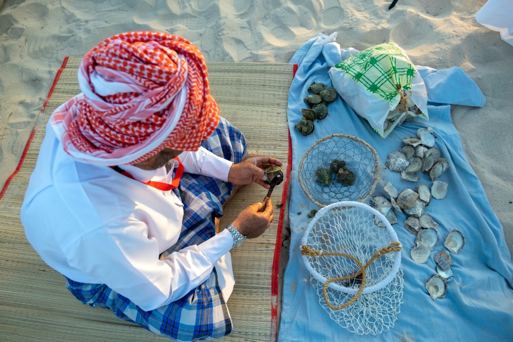
Pearl diving in Bahrain was first mentioned in Assyrian texts dating to 2000 BC, referring to “fish eyes” from Dilmun (ancient polity encompassing Bahrain). Bahrain (as Tylos, Bahrain’s Greek name) was mentioned by Pliny to have been, “famous for the vast number of its pearls”. The golden age of pearling is stated to have been between the 1850s to 1930, when pearls were more precious than diamonds and had attracted jewelers like Jacques Cartier to the country.
There were around 30,000 pearl divers by the end of 1930, as pearling was the principal industry in Bahrain prior to the discovery of oil in 1932. After the collapse of the pearling industry, most divers switched to the newly founded oil sector. Currently, the trading of cultured pearls in Bahrain is prohibited. Few pearl divers remain today.
The Bahrain Pearling Trail (also called the Bahrain Pearling Pathway) is a serial cultural heritage site inscribed on the UNESCO World Heritage List on June 30, 2012. It consists of three oyster beds in the northern waters of Bahrain, a segment of the coast and the seafront Bu Mahir fortress in the southern tip of Muharraq island, and 17 buildings in historical section of Muharraq connected by a 3.5 km visitor pathway.
The site is Bahrain’s second World Heritage Site after the Bahrain Fort. Though the site was inscribed under the label: “Pearling, testimony of an island economy” by the Bahrain Ministry of Culture, the international media has consistently referred to it as the “Bahrain pearling trail”.
Source: Wikipedia
Research:
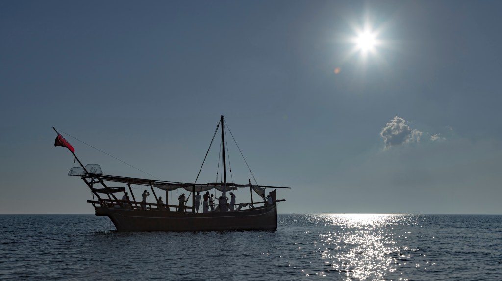
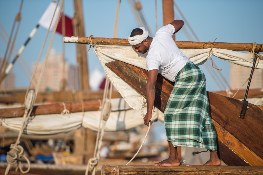
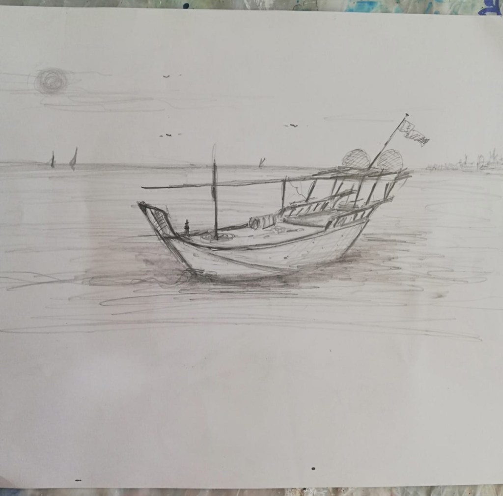
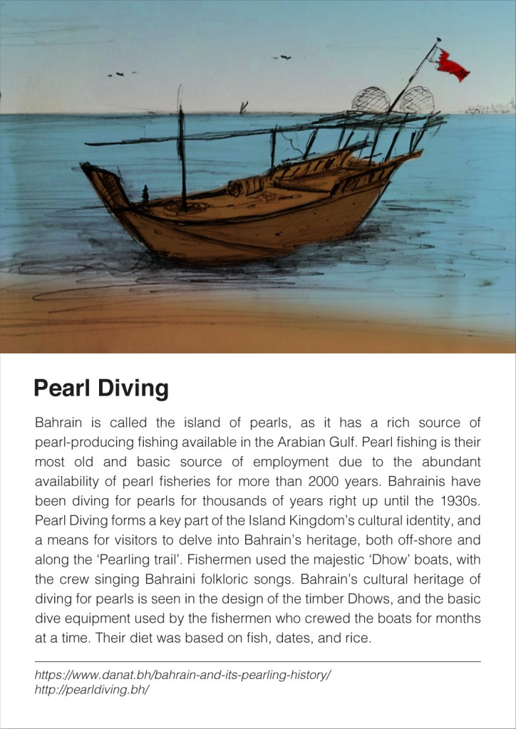
Bahrain is called the island of pearls, as it has a rich source of pearl-producing fishing available in the Arabian gulf. Pearl fishing is their most old and basic source of employment due to abundant availability of pearl fisheries from more than 2000 years. Bahrainis have been diving for pearls for thousands of years right up until the 1930’s. Pearl Diving forms a key part of the Island Kingdom’s cultural identity, and a means for visitors to delve into Bahrain’s heritage, both off-shore and along the ‘Pearling trail’. Fishermen used the majestic ‘Dhow’ boats, with the crew’s singing Bahraini folkloric songs. Bahrain’s cultural heritage of diving for pearls is seen in the design of the timber Dhows, and the basic dive equipment used by the fishermen who crewed the boats for months at a time. Their diet was based on a fish, dates, and rice.
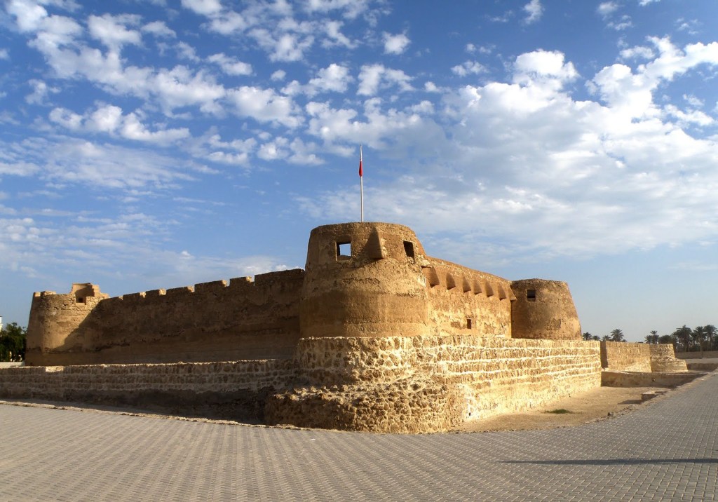
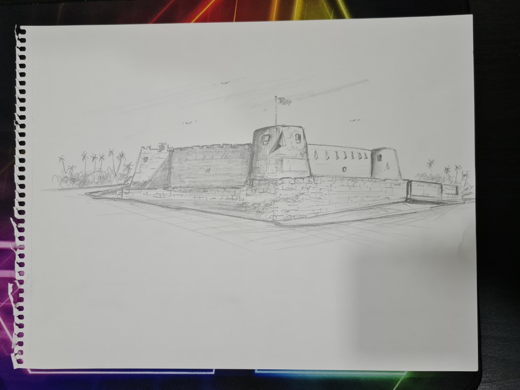
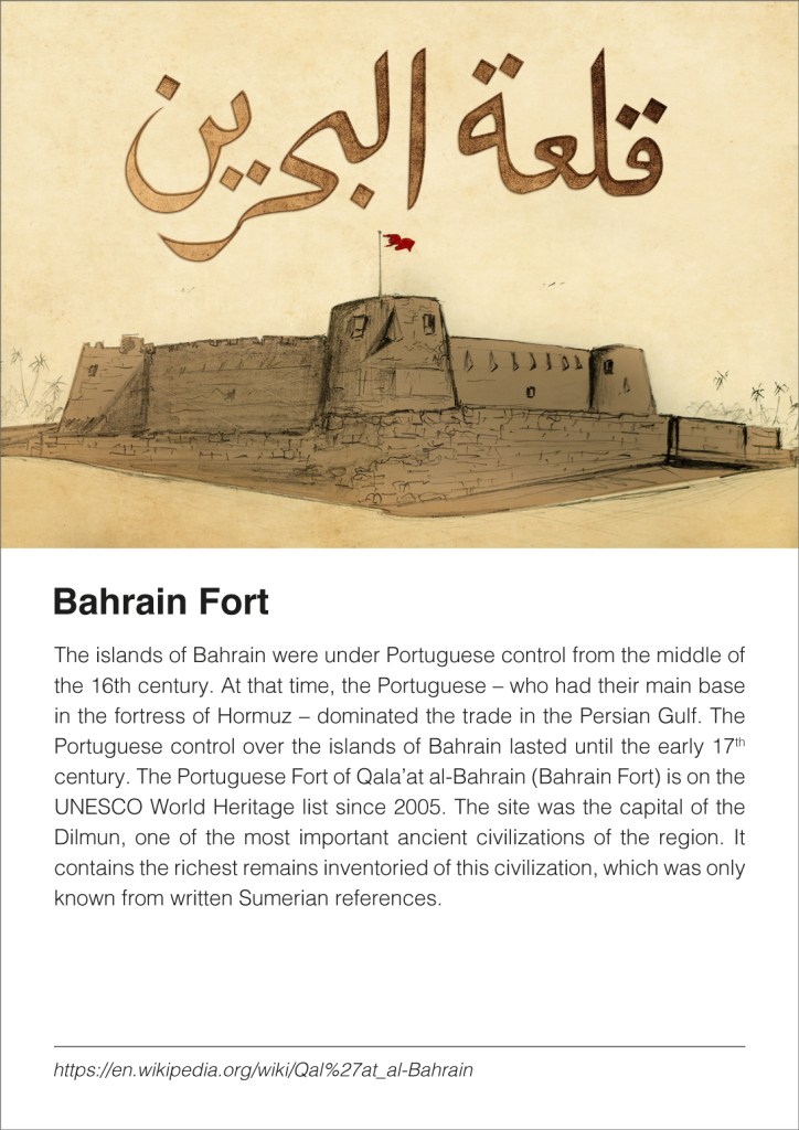
Bahrain Fort
https://en.wikipedia.org/wiki/Qal%27at_al-Bahrain

The islands of Bahrain were under Portuguese control from the middle of the 16th century. At that time, the Portuguese – who had their main base in the fortress of Hormuz – dominated the trade in the Persian Gulf. The Portuguese control over the islands of Bahrain lasted until the early 17th century. The Portuguese Fort of Qala’at al-Bahrain (Bahrain Fort) is on the UNESCO World Heritage list since 2005. The site was the capital of the Dilmun, one of most important ancient civilizations of the region. It contains the richest remains inventoried of this civilization, which was only known from written Sumerian references.
Portuguese rule
The Portuguese first conquered Bahrain in 1521 and maintained rule over the country (with a few brief lapses) from then until 1602. The most visible example of this period is the Qal’at al-Bahrain Fortress on the north coast of the kingdom. The site had been occupied for centuries, but Portugal reconstructed the stronghold as a strategic base from which they could prevent others invading the country, and to stop insurrections. Portugal used indirect rule to maintain control in Bahrain, leading to some revolts by the local inhabitants.
https://whc.unesco.org/en/list/1192/
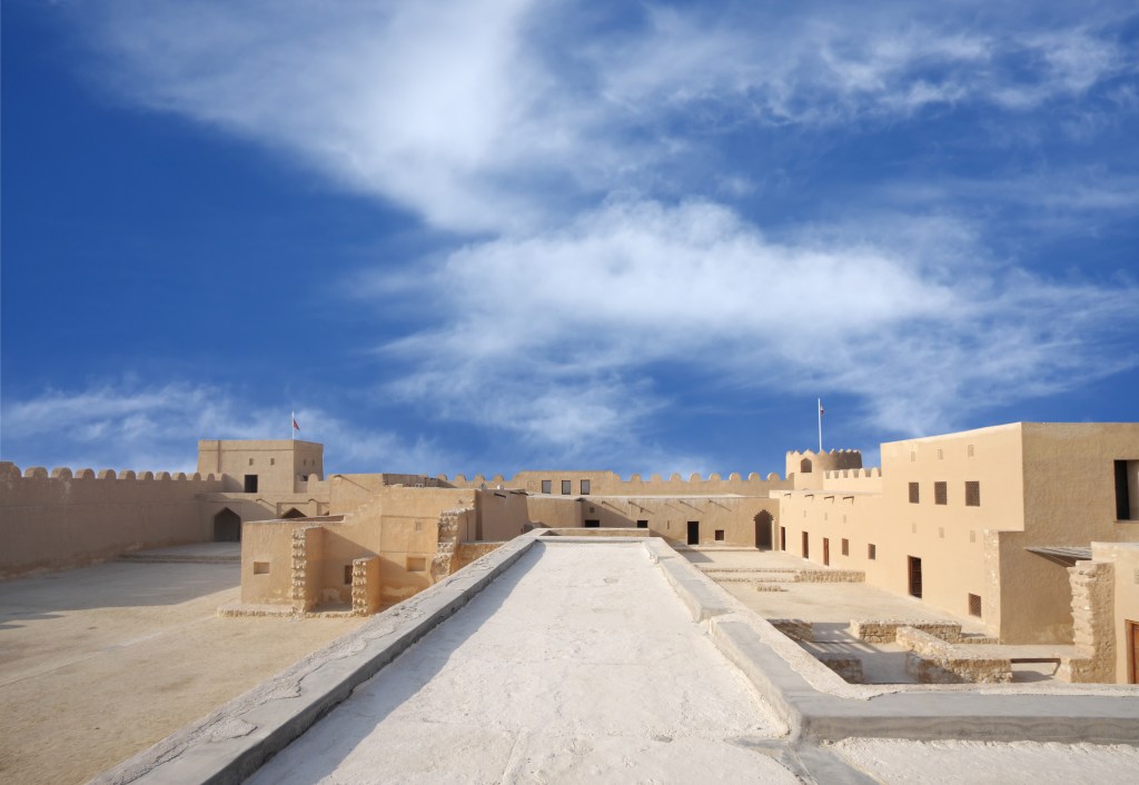
Qal’at al-Bahrain: Ancient Harbour and Capital of Dilmun is an archaeological site comprising four main elements: an archaeological tell (an artificial hill formed over time by successive occupations) of over 16 hectares, immediately adjacent to the northern coast of Bahrain; a sea tower about 1600m North-West of the tell; a sea channel of just under 16 hectares through the reef near the sea tower, and palm-groves. The palm-groves and traditional agricultural gardens surround the site within the whole area of the land component of the buffer zone, being particularly noticeable on the Western and Northern sides, but also occurring on the Eastern and South-Eastern sides. The property is situated in the Northern Governorate, in Al Qalah village district on the northern coast about 5.5 km West of Manama, the present capital of Bahrain.
Qal’at al-Bahrain is an exceptional example of more or less unbroken continuity of occupation over a period of almost 4500 years, from about 2300 BC to the present, on the island of Bahrain. The archaeological tell, the largest known in Bahrain, is unique within the entire region of Eastern Arabia and the Persian Gulf as the most complete example currently known of a deep and intact stratigraphic sequence covering the majority of time periods in Bahrain and the Persian Gulf. It provides an outstanding example of the might of Dilmun, and its successors during the Tylos and Islamic periods, as expressed by their control of trade through the Persian Gulf. These qualities are manifested in the monumental and defensive architecture of the site, the wonderfully preserved urban fabric and the outstandingly significant finds made by archaeologists excavating the tell. The sea tower, probably an ancient lighthouse, is unique in the region as an example of ancient maritime architecture and the adjacent sea channel demonstrates the tremendous importance of this city in maritime trade routes throughout antiquity.
Qal’at al-Bahrain, considered as the capital of the ancient Dilmun Empire and the original harbour of this long since disappeared civilisation, was the centre of commercial activities linking the traditional agriculture of the land (represented by the traditional palm-groves and gardens which date back to antiquity and still exist around the site) with maritime trade between such diverse areas as the Indus Valley and Mesopotamia in the early period (from the 3rd millennium BC to the 1st millennium BC) and China and the Mediterranean in the later period (from the 3rd to the 16th century AD).
Acting as the hub for economic exchange, Qal’at al-Bahrain had a very active commercial and political presence throughout the entire region. The meeting of different cultures which resulted is expressed in the testimony of the successive monumental and defensive architecture of the site including an excavated coastal fortress dating from around the 3rd century AD and the large fortress on the tell itself dating from the 16th century which gives the site its name as Qal’at al-Bahrain, together with the wonderfully preserved urban fabric and the outstandingly significant and diverse finds demonstrating a mélange of languages, cultures and beliefs. For example, a madbasa (an architectural element used to produce date syrup) within the tell is one of the oldest in the world and reflects a link to the surrounding date palm-groves, demonstrating the continuity of traditional agricultural practices from the 1st millennium BC.
The site, situated in a very strategic location, was an extremely significant part of the regional Gulf political network, playing a very active political role through many different time periods, which left traces throughout the different strata of the tell. Qal’at al-Bahrain is a unique example of a surviving ancient landscape with cultural and natural elements.

Omar Mal,
March 4, 2021
